|
|
|
A map of Seville is always handy. Many of you have requested
them and finally I've found a few good ones to post. I've recently added some of my own Seville maps which are the first ones below. Aside
from Seville I've included a few other cities and towns
which are popular travel destinations on your way here.
For now they are posted in PDF format, so if for some reason
you don't have Adobe Acrobat then you can download
it here. I'll be the first to tell you that these maps
aren't very interactive, and there are some really nice
alternatives if you're looking for a specific address. My
favorite is the sevilla5.com - which is really an adapted google map. But there are listings of monuments, hotels, hostals, apartments and
public parking garages with prices (and even photos so you recognize them).
|
|
|
|
I am working on a fairly big map project so you can find just about everything in Seville. Below is a sneak preivew with some helpful maps for Seville at the top, plus the
official tourism brochure which should help you with sights,
monuments history and more.
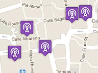
Seville Free WiFi Spots
Dedicated to free WiFi hotspots / connections in Seville. In several plazas you can find free internet sponsored by businesses in the center, or at bars and cafes where you pay the cost of a drink. The Internet connection is otherwise always free. Word on the street is that some newstands will be getting WiFi in the coming year, making Seville even more connected. Wifi Hotspots in Seville >>
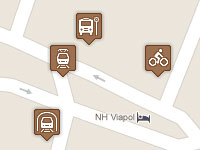
Seville Transportation Map
Seville has a fairly extensive public transportation system. Depending on where you want to go and where you are located there are different options to get you around, to and from the city. This map contains the main public transportation points, including Metro and Tram stops, city bus hubs (points where multiple routes stop), Airport Bus stops as well as Taxi stands in the center. Below you can find individual maps should you wish to concentrate on one type of transportation. Map of Seville Public Transportation >>
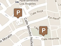
Seville Parking Garages
If you come to Seville by car and you're not staying in a three or four star hotel, chances are you'll be looking for parking. As of October 2011 the traffic control system is still up in the air with traffic (for the moment) open to everyone. Still, for safety
it is often best to find one of the Seville parking
garages in the city center which are open to the public. Seville Parking Garages >>
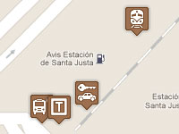
Santa Justa Train Station
Seville's main train station is Santa Justa, built with the 1992 Expo in mind. The station continues to be in great shape and if you arrive by the AVE (high speed train), you'll be getting off here (For other trains you often have the option of San Bernard station - see below). This map includes the locations of the city and airport bus stops, taxi stand and car rental offices. Santa Justa Train Station >>
San Bernardo Train Station
The San Bernardo train station has become a popular point for getting on and off in Seville because it has both Metro and Tram connections directly at the station. Why they decided to connect the smaller station in Seville with these first is confusing to me, but I guess convenient. Just remember the train often stops for very little time compared with Santa Justa, so be ready to get on or off
quickly! San Bernardo Train Station >>
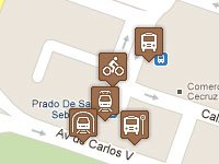
Prado Bus Station
The Prado bus station handles routes for Seville connecting with most of the rest of Andalucia except for Huelva, Other routes leave from the (below mentioned) Plaza de Armas station.
The Prado leaves you close to Santa Justa, the Parque Maria Luisa and the Old Tobacco Factory. There are also Metro, Tram, Airport and city bus stops. Prado Bus Station >>
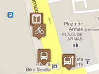
Plaza de Armas Bus Station
The Plaza de Armas bus Station in Seville covers Huelva as well as the rest of Spain outsie of Andalucia. The station is fairly central, especially close to the Arenal, San Vicente and Museum neighborhoods. While there are no Metro or Tram stops, you'll find some bus routes, a taxi stand and a sevici stand (city bike rentals). Also notable: the bus to Italica and Ikea leave from this station. Plaza de Armas Bus Station >>
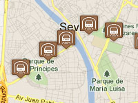
Seville Metro / Underground Map
Seville's maetro is comprised of one main line, Linea 1, which connects many of the outlying neighborhoods. For a tourist there is probably little reason to use the Metro for sightseeing, although it does connect with the San Bernardo train station (but so does the Tram). This map covers the stops the Metro makes in case you want to explore! Map of Seville Matro Stops >>
Seville Flamenco Bars
There are plenty of places to find a little flamenco. This map is dedicated to flamenco bars, where you can find more informal performances in bars and clubs. In many the flamenco is free, while others will have a nomimal charge or require the purchase of drinks for the show. These bars have regular performance schedules - from a dedciated flamenco night to several nights a week. To find a flamenco spot close to you, check ou the Map of Seville Flamenco Bars >>
Seville Flamenco Shows / Tablaos
Seville has a number of professional flamenco shows where you can see longer shows with a drink, tapas or dinner. These shows are your best bet to see a choreographed show with typical flamenco dress. The prices can range from about 15 Euros up to 80 Euors with dinner or tapas. Map of Flamenco Tablaos in Seville >>
Seville Flamenco Penas
Seville has a large number of penas flamencas, which are cultural associations dedciated to flamenco music. These associations often organize regular performances on their own, or in concert series organized across several different penas. There are some which are in the center, with many in the outlying neighborhoods which require a bus or taxi. Map of Seville's Flamenco Penas >>
Seville Flamenco Venues
Find just about all of the options for live flamenco shows in Seville. This map includes flamenco tablaos with more formal shows, flamenco bars, penas flamencas (cultural associations), as well as a few larger venues which often hold concert series. If you're looking for just one of the above you can find specific flamenco maps below. Map of all Seville Flamenco Venues >>
Seville Movie Theatres
All of the move theatres or cinemas in Seville city center and easily accessible neighborhoods. Included are two V.O. (version original) cinemas where you can catch a movie in its original language with subtitiles (these are often English language movies, but also other languages). To find the closest move theatre or the V.O. theatre check ou the Map of Seville Movie Theatres >>
Seville Fresh Food Markets
Seville has a great group of fresh food markets placed throughout the city center. This means you'll always have a market within about 10-15 minutes walk! The markets offer fresh fruits and vegetables, meats, seafood and cheeses. Most have at least one bar (market bars are cheap and often good!), plus a few other stores which may be convenient. Map of Seville Fresh Food Markets >>
Seville Parks and Gardens
One of the things I like best about Seville is that you can walk just about anywhere, thanks to the compact nature of the city center. This also means there is a lot of concrete and asphalt, which leaves me a little blue at times while I look for green spaces! To cure those blues and search for green, check out the Map of Seville Parks and Gardens >>
Real Betis Balompie Stadium and Stadium Grounds Map
As a season ticket holder (socio) and a big Betis fan I've spent a lot of time in and around the stadium. I could wander around here for hours and often do! I've put together a little map which should help you with the different sections, finding the ticket window as well as the bus stops / routes which will get you to the stadium. Find all of the details in my Map of Estadio Benito Villamarin, Real Betis' Stadium >>
Seville Specialty Food Stores
Seville's maetro is comprised of one main line, Linea 1, which connects many of the outlying neighborhoods. For a tourist there is probably little reason to use the Metro for sightseeing, although it does connect with the San Bernardo train station (but so does the Tram). This map covers the stops the Metro makes in case you want to explore! Map of Seville Matro Stops >>
87 Things to do in Seville Map
Seville's maetro is comprised of one main line, Linea 1, which connects many of the outlying neighborhoods. For a tourist there is probably little reason to use the Metro for sightseeing, although it does connect with the San Bernardo train station (but so does the Tram). This map covers the stops the Metro makes in case you want to explore! Map of Seville Matro Stops >>
Seville Metro / Underground Map
Seville's maetro is comprised of one main line, Linea 1, which connects many of the outlying neighborhoods. For a tourist there is probably little reason to use the Metro for sightseeing, although it does connect with the San Bernardo train station (but so does the Tram). This map covers the stops the Metro makes in case you want to explore! Map of Seville Matro Stops >>

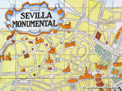
Seville city map - center and monuments
(387kb)
I recommend this map because it contains all of the monuments
and covers all of the city center plus Triana and Los Remedios.
This is part of the larger tourist brochure which can be found
below.

Seville City Bus Route map
(916kb)
Thanks for Paul who pieced together this map from the many
mini maps of Tussam. Here you will find all of the bus routes
and stops in the center as well as outlying neighborhoods.

Centro, Macarena, La Cartuja
(223 KB)
Older map which is broken into quadrants, and thus the names
above to indicate which neighborhood they cover.

Santa Cruz, Arenal, San Bernardo, Triana, Los Remedios,
El Porvenir
(477 KB)
Older map which is broken into quadrants, and thus the names
above to indicate which neighborhood they cover.

Map of Seville Province
(591KB )
If you want to find all of the smaller towns and where they
lie in relation to the city, then this province of Seville
map is a good starting point.

City Map of Seville Highways and Main Roads
(299 KB)
Good for finding the entrance and ring (loop) roads in and
around Seville. This gives you a general idea of how to get
into and out of Seville depending on your destination or where
you are coming from.

Official Tourism brochure with map
(1,988 KB)
The whole tourist offering for Seville with history, walking
routes and monuments. A few of the maps above come courtesy
of this brochure. I choose to split them up in case you wanted
everything or just the useful maps.
Online maps (callejeros)
There are also plenty
of online maps, allowing you to enter an address and then
navigate around using different controls. These can be handy
for locating parking and other services close to a certain
address. And of course for pinpointing an exact location or
destination. A favorite is qdq.com, which offers a callejero
fotografico - enter an address in tehc ity center and you
can see photos of the actual location. But be careful - some
photos are out of date! Below are some links:
Qdq.com: navigate
as if you were walking down the street itself. Enter an address
and then see photos of the location.

City Map of Córdoba
(531 KB)

City Map of Granada
(575 KB)

City Map of Jerez
(322 KB)

City map of Madrid N: Quevedo S: EstSur Autobuses E:
Retiro W: Palacio Real
(309 KB)

City map of Madrid N: Ventas S: Vallecas E: M-30 W:
Retiro
(483 KB)

City map of Madrid N: Chamartín S: Av America
E: Parque Berlin W: 4 Caminos
(109 KB)

City map of Madrid N: Noviciado S: Embajadores E: Cibeles
W: Opera
(75 KB)

City Map of Madrid Highways and Main Roads
(701 KB)

City Map
(307 KB)
|
|
|
|
|